The new Midpoint of Germany - Mihla

Tourists and locals who move around the Hessian-Thuringian border area today find many communities that advertise for attention with the title: "Midpoint (Centre) of Germany".
But how is this possible?
Any area is only ever defined by exactly one midpoint! At least that's what three students from Erfurt thought about the midpoint of Germany.
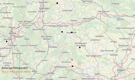
During their research they quickly found what they were looking for. The emerging complexity in calculating the midpoints of large geographical areas, depending on the computa-tional resources available, has led to a variety of calculation methods over the past decades, which are still in use today. Thuringia and Hesse have therefore known at least 5 different midpoints of Germany since 1990, with the most famous midpoint in Germany being Niederdorla. You can find more information about the previous midpoints under the menu on the top right of this page or under the button below.

Is this still applicable in the 21st century?
There is a need for action, the three students from Erfurt concluded. Quickly, the idea was born to address the topic within the scope of their seminar paper "The Dispute Over the Midpoint of Germany - Problem Analysis and Solution" and to develop a method for the universally binding determination of the midpoint. The idea of using modern computing power, which was not available to surveyors in the past, came to the aid of the computer science students.
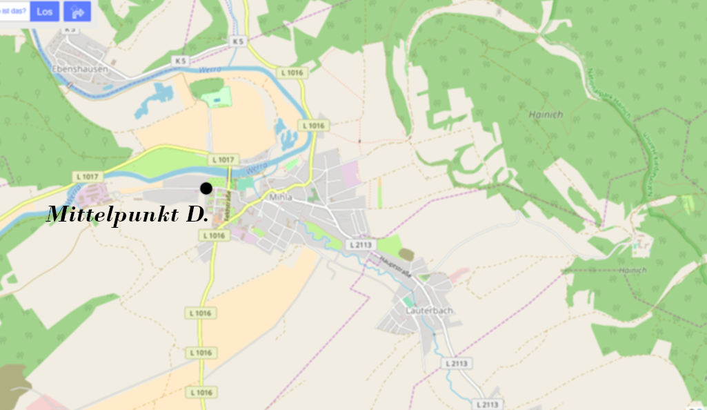
Today the new midpoint of germany is located in the western part of Mihla. - Why?
In 2018, the three students from Erfurt developed and implemented a calculation method that corrected the weaknesses of previous methods, using modern computing technology. By filling Germany with around one million squares and then identifying the most central square, they were able to determine the midpoint of Germany to be the town Mihla. The squares used had a side length of about half a kilometer. Additionally, they were able to calculate the area of Germany as 359,000 square kilometers. The results are based on roughly 68,000 official coordinates of the German border from the Federal Agency for Cartography and Geodesy.
Representative of this, the squared map of Germany with a total of 1,074,000 filled squares at a resolution of 112 megapixels is depicted below. The midpoint is colored RED, and the outermost point green (Island Sylt). The more central a square is, the darker it is colored. Both images are downloadable in PNG format. More information about the program code and the underlying coordinates can be found at the following GitHub-Page.
This new calculation method is referred to as the Method of Squaring and is described in more detail on the following subpage:
In the Wikipedia article about the midpoint of Germany, the Squaring Method is mentioned under
"Bestimmung mittels einfacher geometrischer Figuren" as method
"Minimale Entfernungssumme nach Aufteilung der Landesfläche in (quadratische)
Teilflächen".
The coordinates of the calculated midpoint in Mihla are: 51.077722, 10.323694 (51°04'39.8"N 10°19'25.3"E, Accuracy: +/- 0,25 km)


Mihla
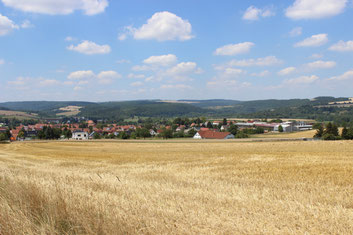
Mihla is a small town with 2,100 inhabitants and is located in western Thuringia. The community, which is close to nature, is one of the oldest settlements in Thuringia, first mentioned in documents in 780. With several attractions in Mihla and the surrounding area, Mihla offers many leisure activities and is a tourist-friendly place. Furthermore, Mihla is surrounded by numerous hiking trails in the Hainich National Park and the Werra Valley and is also on the Werra cycle path. Further information from the community about tradition, tourism and history can be found on the Mihla community website.


© OpenStreetMap-Contributors